SKILL LEVEL
moderate
Our team is here to support you 24/7. Please feel free to provide your queries. You will get response within few minutes.


One of the best off-the-beaten-path treks in Nepal, you’ll follow a circuit around the 8th highest peak in the world in the remote conservation region of Manaslu. Only developed as a teahouse trek in 2010, the trek features all of the great aspects of a classic Himalayan experience: spectacular views, a high-altitude pass, and a mix of cultures as you pass through traditional Gurung and Tibetan villages and Tibetan Buddhist monasteries. This is a strenuous trek, so it’s recommended that you either have trekking experience or a good level of fitness

17 Days Trekking / (SKILL LEVEL: moderate)
Flying into Kathmandu, you’ll have views over the valley, the Himalayas, and the terraced fields below. After completing customs, a representative will be waiting to greet you outside the airport and to guide you through the initial culture shock of Kathmandu’s narrow, winding streets to your hotel.
After breakfast at your hotel, you’ll be picked up by an English-speaking guide for a full-day tour of the Kathmandu Valley, visiting three sacred sites: Swayambhunath, Pashupatinath, and Patan Durbar Square.
This day fits quite a bit in — helpful for maximizing your time in Kathmandu — but doesn’t overload you with too many sites. You can spend as much time as you like at each temple (this is a private tour just for you), although most people tend to spend an hour. For lunch, you’ll stop at one of our recommended local restaurants.
Return to your hotel in Kathmandu in the late afternoon and meet your trekking guide who will go over details for tomorrow’s adventure.
Tour length: 7-8 hours (including transfers)
We drive along the Kathmandu-Pokhara Highway for the first part of the day; we turn off towards the hill bazaar of Dhading. After Dhading the road gets a bit rough but we will reach our destination, Sotikhola, in approximately 8-10 hours from Kathmandu.
Transport: Private jeep
Driving time: 8-10 hours
Accommodation: Teahouse
After breakfast in Soti Khola, you’ll begin this epic trek up and down through various landscapes including forests, rice paddies, a cliff-face ridge, a rushing river, and several beautiful waterfalls. The journey begins by crossing a bridge before you trek through a forest, then climb onto a ridge above the wild rapids of the Budhi Gandaki River (which is joined from the Tum Khola River in the Tibetan highlands).
You’ll then reach Khursane on a rocky trail, past two tropical waterfalls on a steep, rocky trail clinging to the side of a cliff. You’ll eventually descend past a few ride paddies, then continue up and around to the picturesque Gurung village of Labubesi.
From here, you’ll further climb near a rocky outcrop where the valley opens up next to the river, which flows more peacefully here. Dropping down to the river shore, you’ll walk along rounded stones before climbing over a side ridge. Head down again to the river and cross another suspension bridge to reach the village of Machha Khola.
Trekking time: 6-7 hours
Trekking distance: 8 miles (14 km)
Accommodation: Teahouse
This morning we have a few hours of walking by tobacco and buckwheat fields, past rocks washed smooth by the river until we reach the hot springs in the center of the small, terraced village of Tatopani, where we stop for lunch. A gentle climb through the woods past some spectacular waterfalls, across another suspension bridge, and through a short section of forest path and we reach Dobhan.
Our route continues upstream, and again we have a steep climb to reach Philim and its Japanese-sponsored school. It’s a shorter day today, only about three hours, so we have the afternoon free to explore the interesting upper village, or sit and enjoy the afternoon at our tea house.
Walking time: Approx. 7 hours
Accommodation: Teahouse
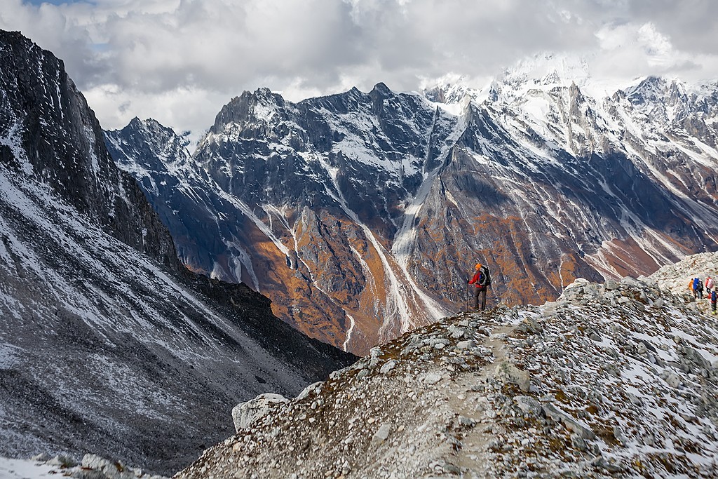
At the start of our four to five-hour day, we pass through Eklai Bhatti (which means Lone Tea House), and then on through a narrow, dramatic gorge section with towering walls, and past a thundering waterfall just above us on the right of the trail. We cross the river three more times in the next two hours (often small, badly maintained bridges, Nepali style) to avoid the difficult valley sides; the first bridge, a new one, is at the intersection of Tsum Valley, a remote valley leading to Tibet. After trekking through dense woods for over an hour, we pass the cold campsite of Pewa on the river, and after another hour we leave the gorge and climb briefly to the small village of Deng.
This is the start of the lower Nubri region called Kutang, where the people are ethnically Tibetan but speak a different dialect than the people of upper Nubri where the people are pure Tibetans. The Kutang dialect, called ‘kukay’, is a mix of Tibeto-Burman and Gurung. We have views of Lumbo Himal to the rear, as well as Lapuchen and Dwijen Himals.
Walking time: Approx. 5-6 hours
Accommodation: Local Tea House
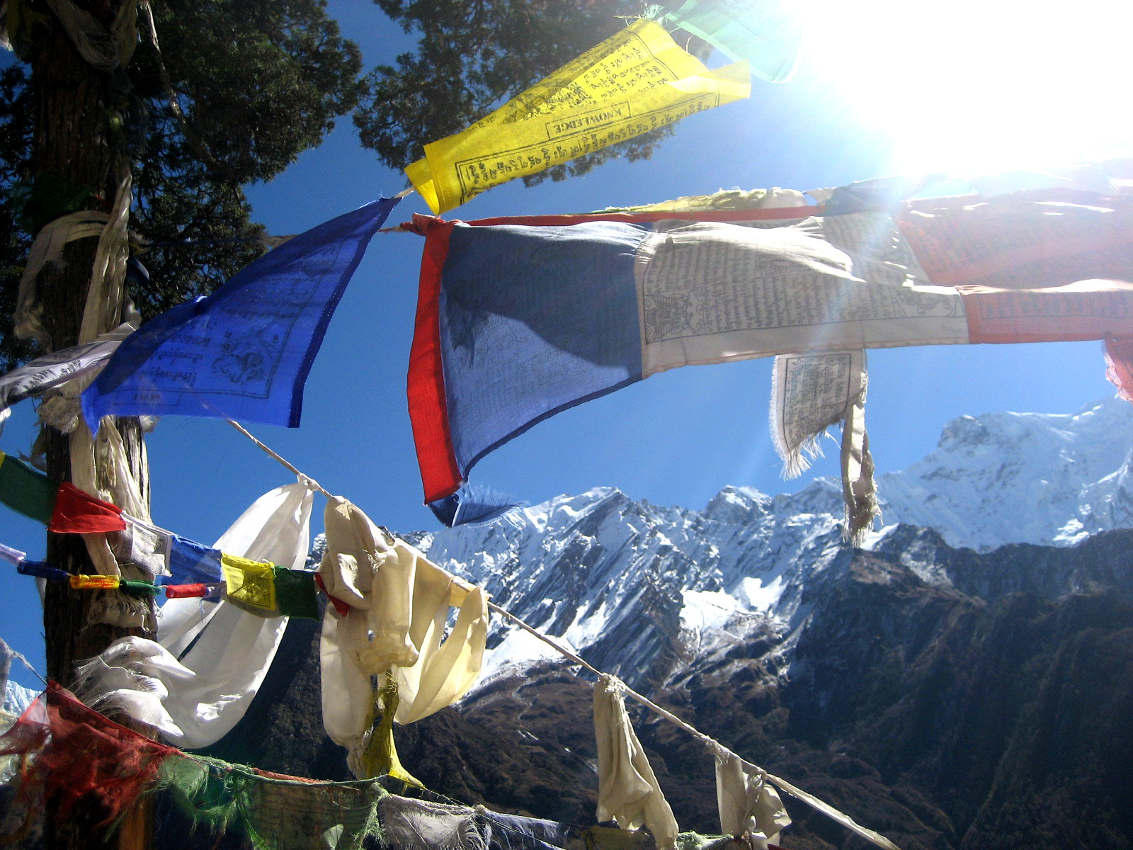
Today is another five-hour day. The valley is still steep-sided and impressive but after about twenty minutes we cross the bridge and switch back up to the village of Lana and then Bihi Phedi, where there is a good shop and views of Kutang Himal. From here we start to see mani stones (prayers etched onto wayside rocks), a sure sign that we are entering another of the tiny footholds of Tibetan culture that mark the high Himalayan places.
We have about four hours of trekking ahead of us, twice crossing the large Budhi Gandaki and twice over smaller tributary streams, staying mostly high with many ascents and descents as we walk through the gorge, all the time enjoying spectacular views. Eventually, we reach Ghap, and our tea house for the night. The eggshells strung above the doors are to prevent the evil spirits from entering the houses.
Walking time: Approx. 5 hours
Accommodation: Local Tea House
After breakfast in Ghap, you’ll follow the trail upstream along the river through a dense forest with a few houses and even an animal shelter. After crossing the river at an impressive spot where the view turns toward a narrow gorge, the forest becomes less dense.
You’ll make one last steep climb to reach Namrug and then climb steadily in the shade of a forest as it takes you to Lihi, a village with barley fields. Take a break here and enjoy the views of Ganesh Himal behind you.
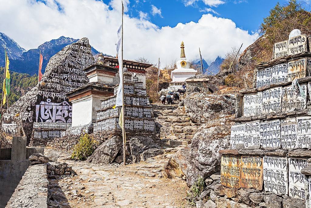
The trail then drops down and crosses the valley of Simnang Himal. (Look for the stupa with detailed paintings.) You’ll reach Sho, another nice village with fine views up the open valley. Make one final steep climb along a slope and you’ll reach several houses lined up on a ridge at Lho.
Trekking time: 5-6 hours
Trekking distance: 9.5 miles (15.2 km)
Accommodation: Teahouse
After breakfast in Lho, the trail continues over the Damonan Khola where you’ll follow a small tributary and walk in a shady pine forest. This pleasant walk leads to a short climb to a plateau village where you can gaze upon big snow-capped mountains all around you: Himal Chuli and Peak 29 to the left, Manaslu and large glaciers straight ahead, and Ganesh Himal at the far end of the valley.
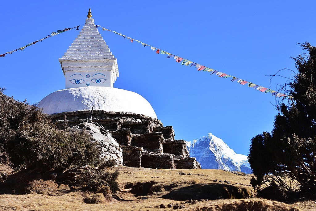
You’ll come across a large stupa and then get to a valley where the well-known monastery of Kargu Choling Monastery in Samagaun.
Trekking time: 4-5 hours
Trekking distance: 4 miles (6.4 km)
Accommodation: Teahouse
Today is an acclimatization day, so sleep in and relax. Enjoy a refreshing breakfast and then spend the day at Samagaon getting some rest.
For those who want to explore, there’s an optional day hike that explores some rich Sherpa culture. You can enjoy the sight of thousands of mani stones with Buddhist texts, as well as photos of Sherpa women clad in traditional clothes and ornaments. If you hike up to a little hill near the Sama village, you’ll find an old gompa—Pungyen Gompa—a monastery with great views of the glacier.
After breakfast in Samagaon, you’ll descend to the Budhi Gandaki River and follow it to a bridge over a side stream. You’ll pass several mani walls as the valley begins to widen. The mountain views along this route are amazing and get you close to the Tibetan border.
This is an easy trek on a shelf above the river that passes juniper and birch forests in Kermo Kharka. Drop down and cross the Budhi Gandaki on a wooden bridge, and then climb steeply onto a promontory between two forks of the river. You’ll come to a stone archway and continue walking until you find the village of Samdo.
Trekking time: 4 hours
Trekking distance: 10.1 miles (16.4 km)
Accommodation: Teahouse
Today is another day set aside for proper acclimatization. After breakfast, you can either rest in Samdo or choose between two hiking options:
Option 1
Take an easy trail up the valley directly behind Samdo to one of the trade passes headed for Tibet. This route has excellent views of Manaslu along with other Himalayan ranges including Simrang, Hiunchuli, Ngadi, Larkye Peak, Cheo, and possibly Kang Guru behind the pass. En route to these viewpoints, you will pass many seasonal herding settlements called doksas and see some beautiful mountain birds like the Lophophorus (the national bird of Nepal), Lammergeyer, and Himalayan Griffin soaring above.
Option 2
A more challenging route is the trek to the Gya La (large pass) north of Samdo—a more frequently used trading route to Tibet. This is a longer full-day hike and is not advised for those seeking a little rest.
After breakfast in Samdo, you’ll pass a seasonal Tibetan market called Larke Bazaar and descend to the Budi Gandaki River. Cross the wooden bridge and begin walking upward, crossing two streams while witnessing the Larkya Glacier. You’ll head around the valley of the Salka Khola and climb up again to Dharamsala, also known as Larke Phedi. Along the route, you’ll see many traditional monasteries.
Today’s shorter hike leaves time for acclimatization and relaxing in the afternoon.
Trekking time: 4-5 hours
Trekking distance: 7.2 miles (11.7 km)
Accommodation: Teahouse
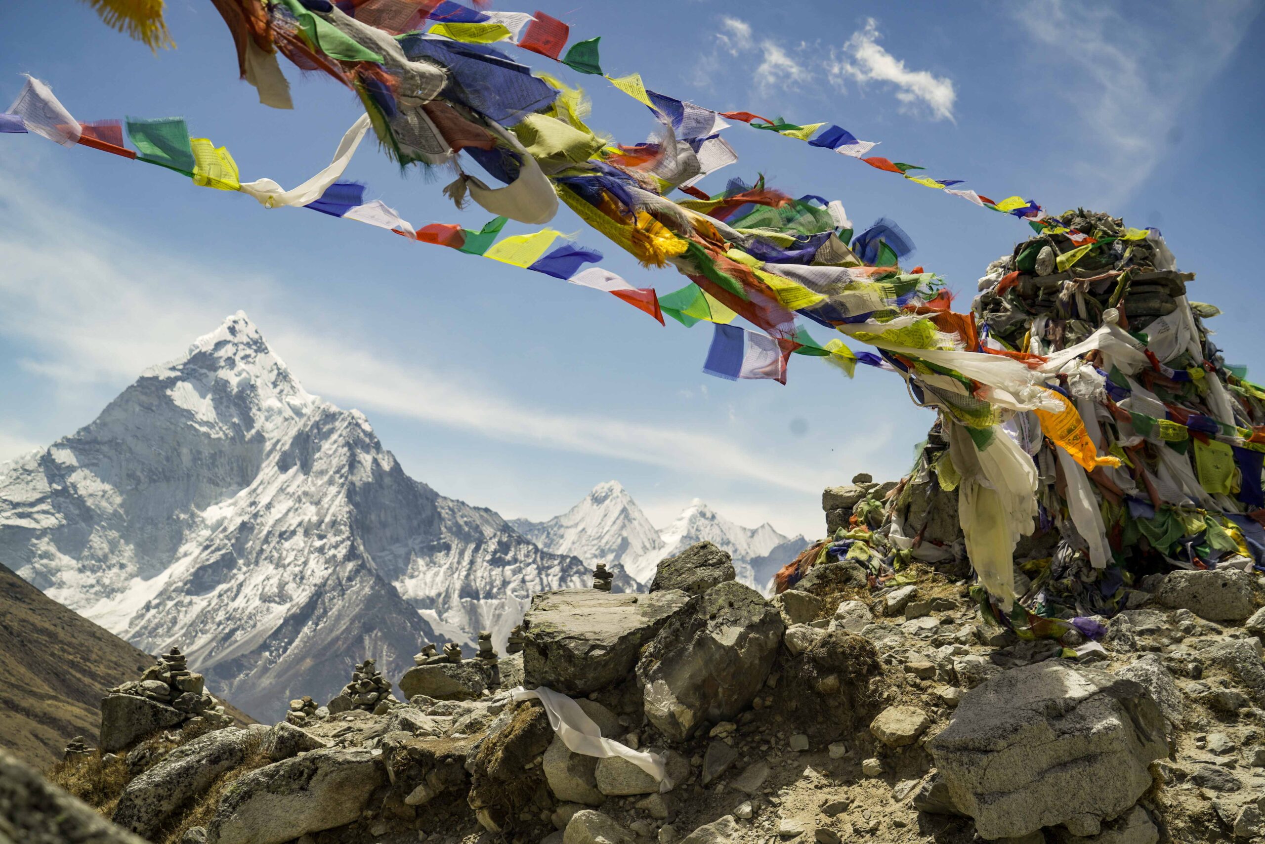
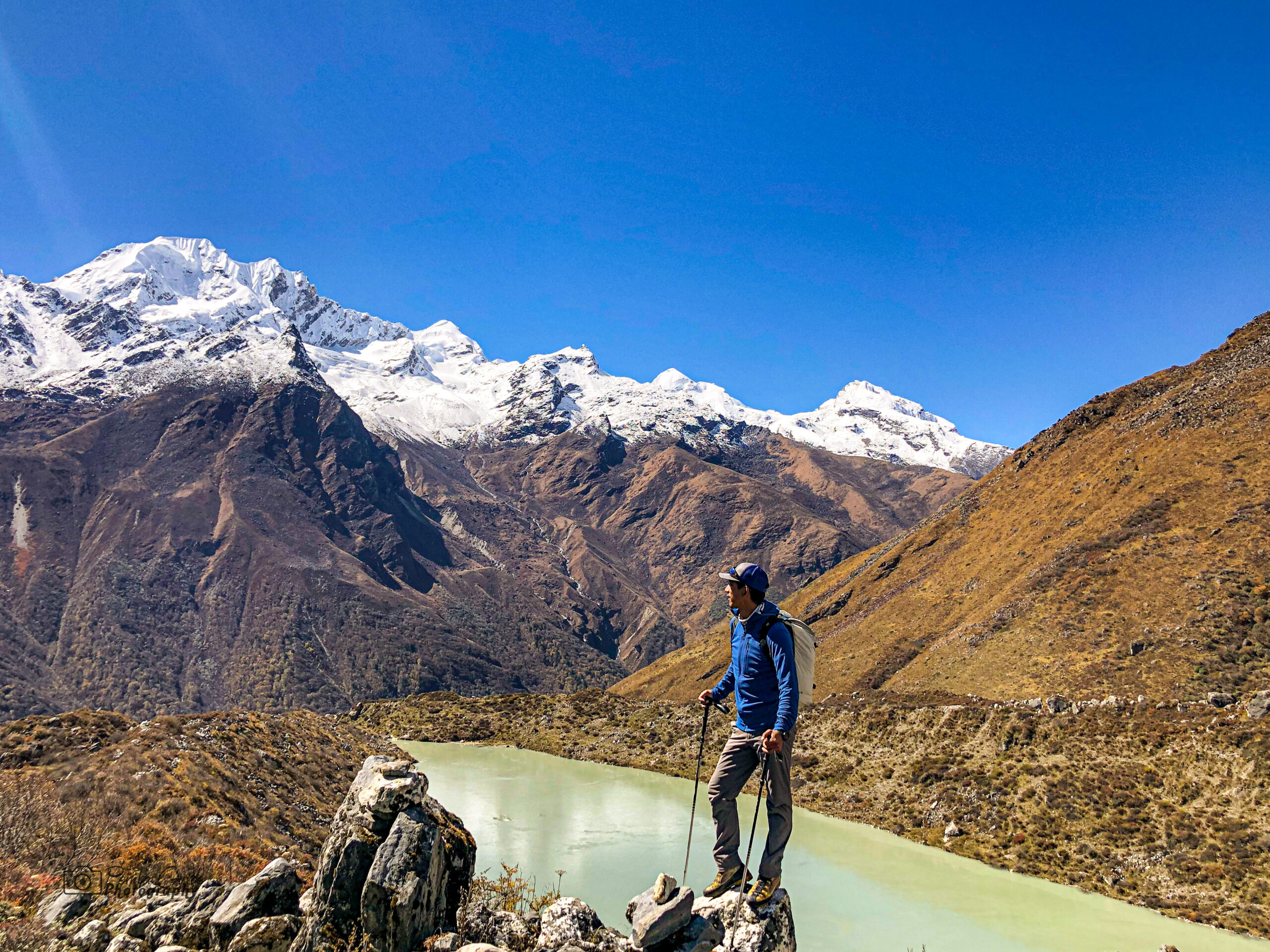
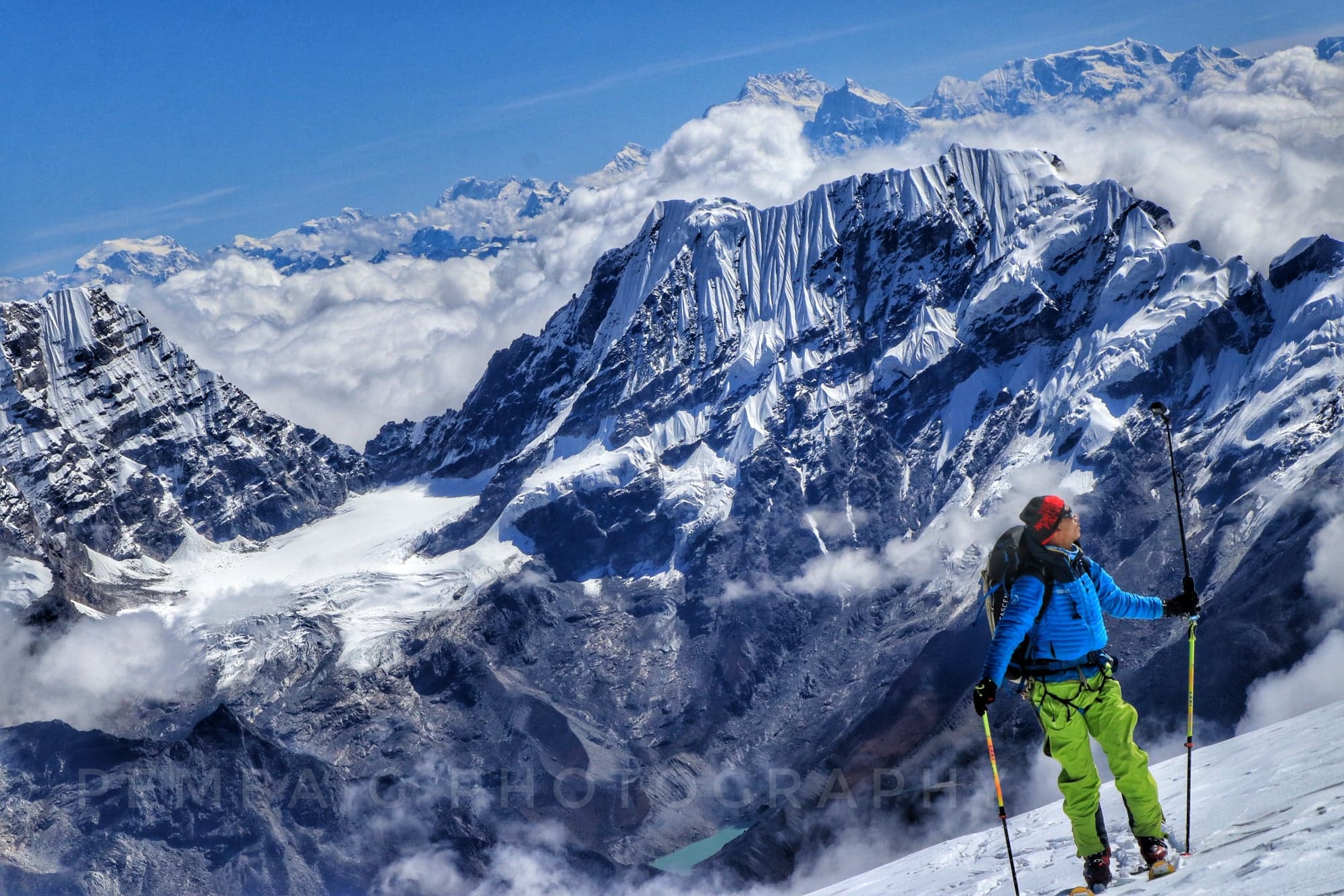
Today you’ll set out on a longer hike so eat a hearty breakfast in Dharamsala. Though it’s a more challenging trail, you’ll encounter several rustic villages, clear glacier lakes, beautiful valleys, and a wide range of flora and fauna, not to mention some notable snowcapped peaks.
After a short climb, you’ll reach a valley on the north side of the Larkya Glacier from where you can enjoy great views of Cho Danda and Larkya Peak. You’ll walk across the moraines of the glacier, making a gradual ascent, which becomes steeper in the last section of the pass. From here, there are outstanding views of Himlung Himal, Cheo Himal, and the massive Annapurna II. You’ll finish with a rewarding walk into misty low pastures in the early evening with Mount Manaslu looming in the distance.
Trekking time: 7-9 hours
Trekking distance: 15.3 miles (24.7 km)
Accommodation: Teahouse
Bimtang is frigid in the morning, so getting up for a cup of warming tea is a good idea! To get warm, we move down the valley into the sun, through forested hillsides to Tilje, at the end of our lost world. Here the inhabitants are a mix of Manangis (of Tibetan descent) and Chettris (Hindus), so they eat a mix of dal bhat, buckwheat dhido, tsampa, and Tibetan tea.
The gorge ahead marks the land of apple pie, cold beers, and hot showers – the Annapurna Circuit trail and almost the end of our trail. We continue through the bamboo forest and the last stop of our trek, Dharapani.
Trekking time: 6-7 hours
Accommodation: Teahouse
In the morning, you’ll say goodbye to the crew and pack up the jeep for the drive back to Kathmandu, stopping for lunch in Kurintar. Expect to be back in Kathmandu by mid-afternoon.
In Kathmandu, you’ll be dropped off at your hotel and have the rest of the afternoon free. Explore the city’s streets by foot, bicycle, or rickshaw, perhaps shopping for souvenirs or visiting sites you missed at the beginning of your trip.
Driving time: 6-7 hours (126 miles / 202 km)
Accommodation: Hotel